
Research
Browse projects by topic or search by keyword.
Browse projects by topic or search by keyword.
Try adjusting your filters or search keywords.

We propose a new task, mixed-view panorama synthesis, in which a satellite image and a set of nearby panoramas are used to render a panorama at a novel location. Our approach uses diffusion-based modeling and attention to enable flexible, multimodal control.

This work addresses the task of modeling spatiotemporal traffic patterns directly from overhead imagery, which we refer to as image-driven traffic modeling. Our approach includes a geo-temporal positional encoding module for integrating geo-temporal context and a probabilistic objective function for estimating traffic speeds that naturally models temporal variations.
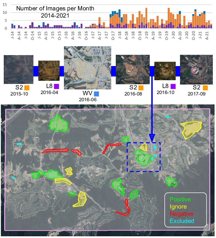
In this work, we introduce an adaptable framework and network architecture capable of predicting on subsets of the available platforms, bands, or temporal ranges it was trained on. Our system, called WATCH, is highly general and can be applied to a variety of geospatial tasks.
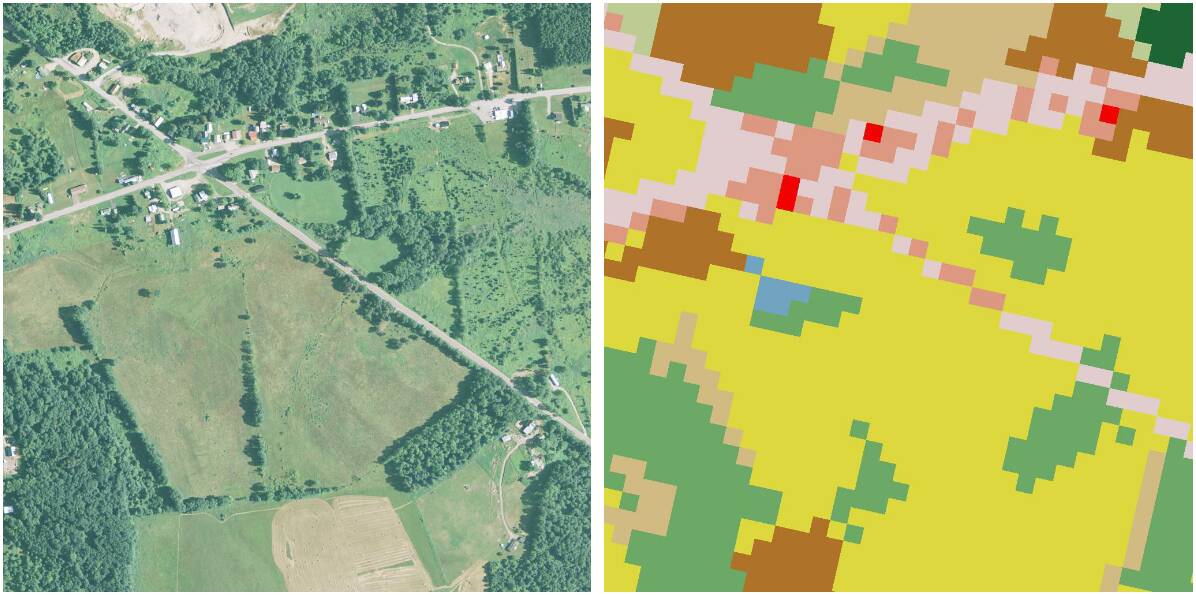
We present a method that is supervised only using low-resolution labels, but takes advantage of an exemplar set of high-resolution labels to guide the learning process.

We introduce a novel architecture for near/remote sensing that is based on geospatial attention and demonstrate its use for five segmentation tasks.
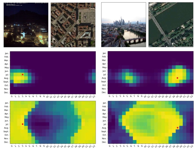
We propose an end-to-end approach to verify whether the purported time of capture of an outdoor image is consistent with its content and geographic location.
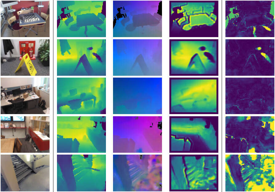
We propose a direct pose estimation method that takes inspiration from structure-based approaches to incorporate explicit 3D constraints into the network.
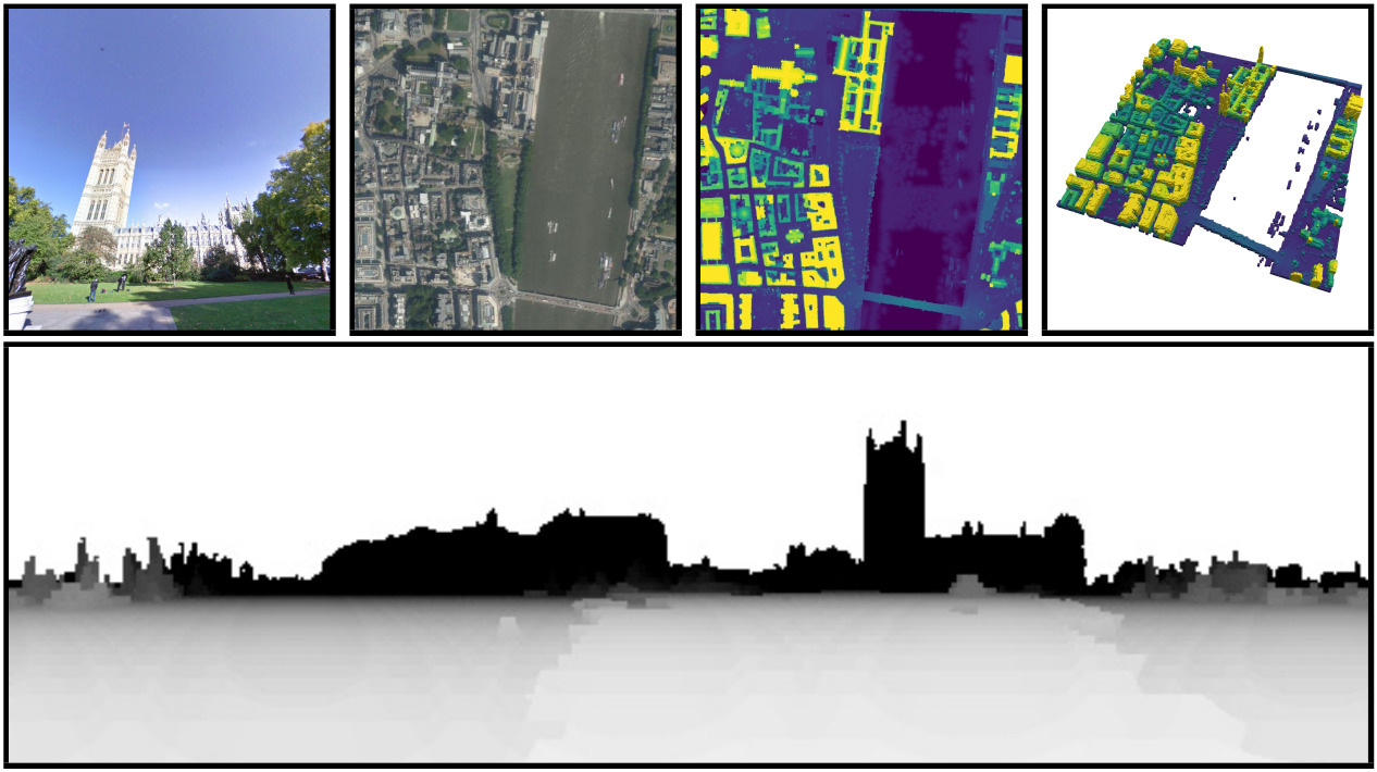
We explore a new problem, geo-enabled depth estimation, in which the geospatial context of a query image is exploited during the depth estimation process.
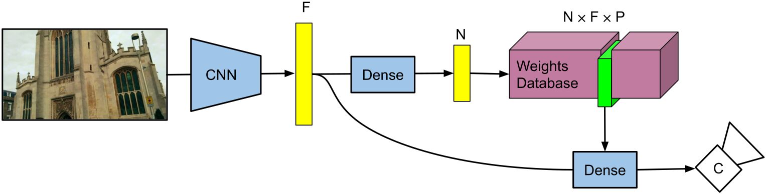
We propose a novel architecture, Multi-Scene PoseNet (MSPN), that allows for a single network to be used on an arbitrary number of scenes with only a small scene-specific component.
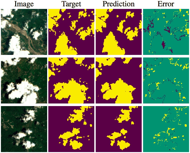
Artifacts in imagery captured by remote sensing, such as clouds, snow, and shadows, present challenges for various tasks, including semantic segmentation and object detection. A primary challenge in developing algorithms for identifying such artifacts is the cost of collecting annotated training data. In this work, we explore how recent advances in multi-image fusion can be leveraged to bootstrap single image cloud detection.
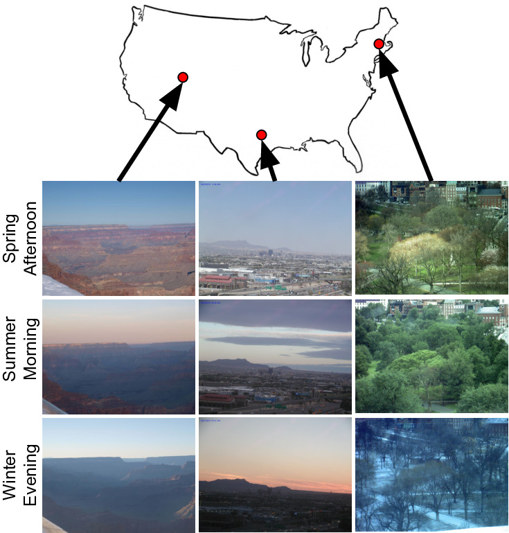
Our approach integrates dense overhead imagery with location and time metadata into a general framework capable of mapping a wide variety of visual attributes.
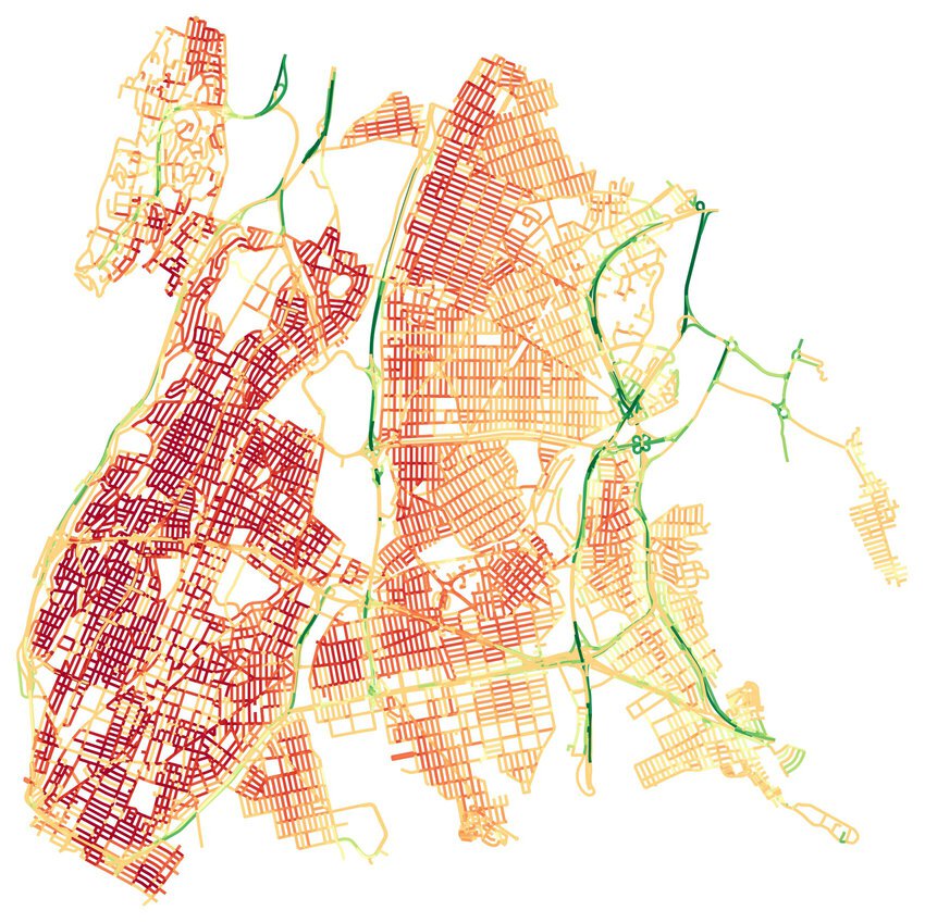
We propose an automatic approach for generating dynamic maps of traffic speeds using convolutional neural networks. Our method operates on overhead imagery, is conditioned on location and time, and outputs a local motion model that captures likely directions of travel and corresponding travel speeds.
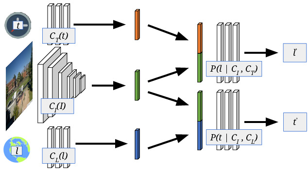
We propose to implicitly learn to extract geo-temporal image features, which are mid-level features related to when and where an image was captured, by explicitly optimizing for a set of location and time estimation tasks.
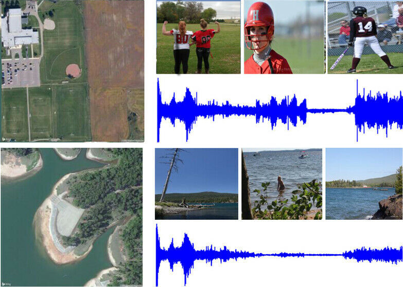
We explore the problem of mapping soundscapes, that is, predicting the types of sounds that are likely to be heard at a given geographic location.
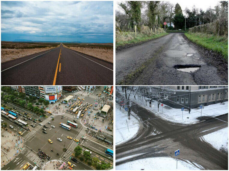
We address the task of automatically assessing the safety of roadways for drivers. Such ratings can be used by highway authorities to decide, using cost/benefit analysis, where to invest in infrastructure improvements.
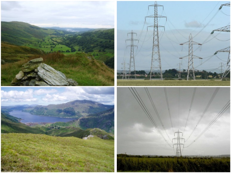
We demonstrate that quantitative measures of scenicness can benefit semantic image understanding, content-aware image processing, and a novel application of cross-view mapping, where the sparsity of ground-level images can be addressed by incorporating unlabeled overhead images in the training and prediction steps.
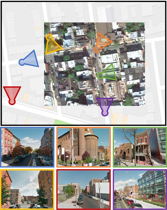
We propose a novel convolutional neural network architecture for estimating geospatial functions such as population density, land cover, or land use. In our approach, we combine overhead and ground-level images in an end-to-end trainable neural network, which uses kernel regression and density estimation to convert features extracted from the ground-level images into a dense feature map.
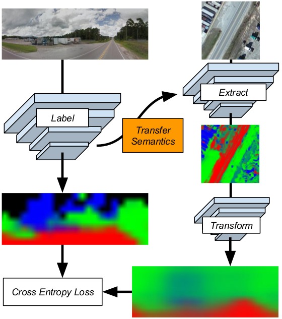
We introduce a novel strategy for learning to extract semantically meaningful features from aerial imagery. Instead of manually labeling the aerial imagery, we propose to predict (noisy) semantic features automatically extracted from co-located ground imagery. Our network architecture takes an aerial image as input, extracts features using a convolutional neural network, and then applies an adaptive transformation to map these features into the ground-level perspective.
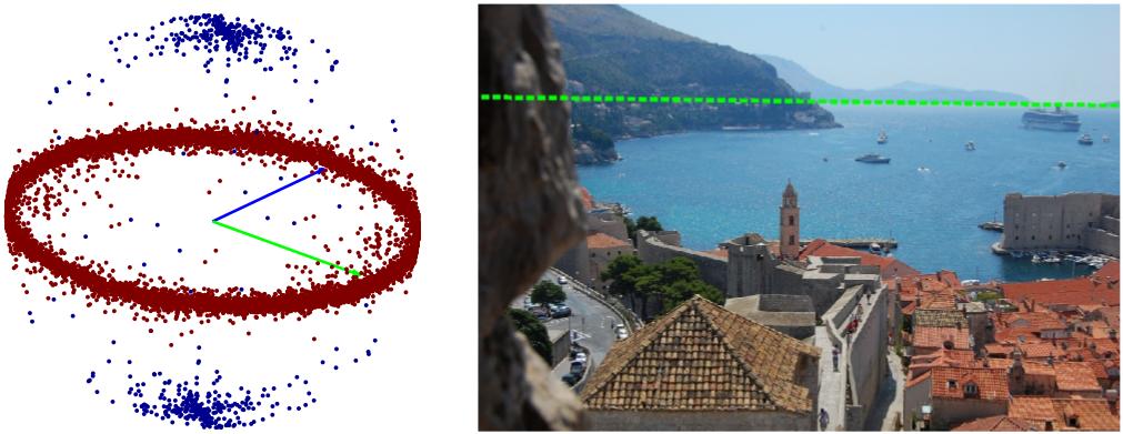
We introduce a large, realistic evaluation dataset, Horizon Lines in the Wild (HLW), containing natural images with labeled horizon lines. Using this dataset, we investigate the application of convolutional neural networks for directly estimating the horizon line, without requiring any explicit geometric constraints or other special cues.
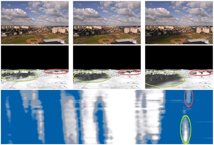
Cloud shadows dramatically affect the appearance of outdoor scenes. We describe three approaches that use video of cloud shadows to estimate a cloudmap, a spatio-temporal function that represents the clouds passing over the scene.
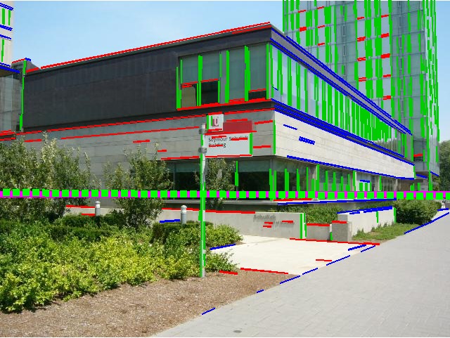
We introduce a novel vanishing point detection algorithm that obtains state-of-the-art performance on three benchmark datasets. The main innovation in our method is the use of global image context to sample possible horizon lines, followed by a novel discrete-continuous procedure to score each horizon line by choosing the optimal vanishing points for the line.
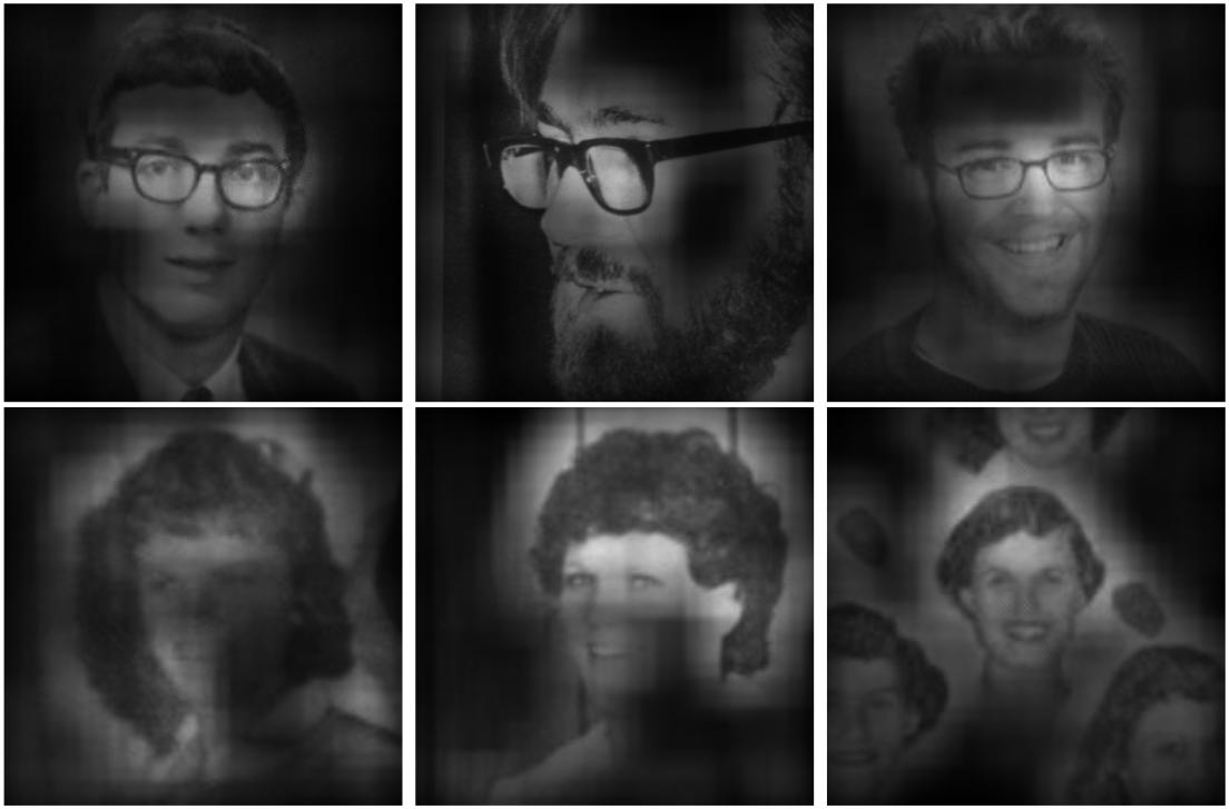
Given an image, we propose to use the appearance of people in the scene to estimate when the picture was taken.
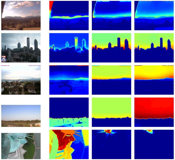
This paper presents the results of a large-scale empirical evaluation of the performance of three state-of-the-art approaches on a new dataset, which consists of roughly 100k images captured “in the wild”.
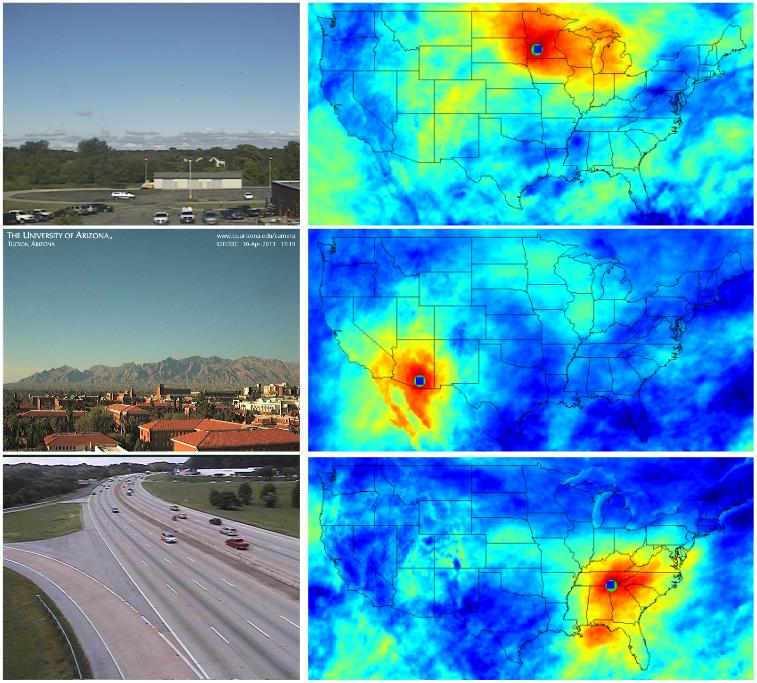
We describe a fast method for estimating transient scene attributes for a single image. Using our method, we explore applications to webcam imagery, including: 1) supporting automatic browsing and querying of large archives of webcam images, 2) constructing maps of transient attributes from webcam imagery, and 3) geolocalizing webcams.
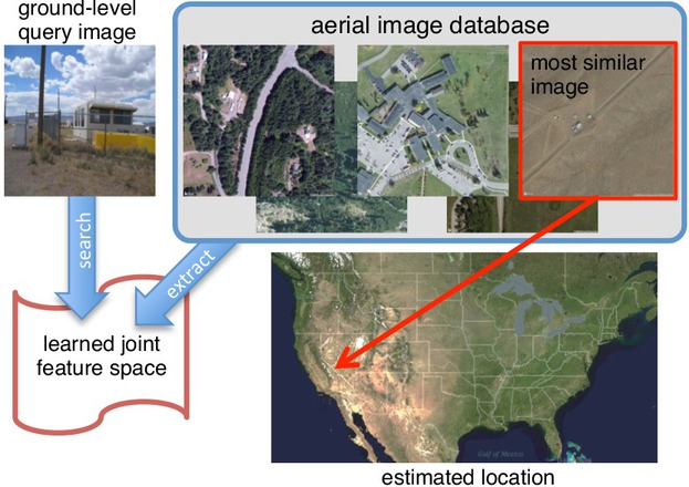
We learn a joint feature representation for aerial and ground-level imagery and apply this representation to the problem of cross-view image geolocalization.
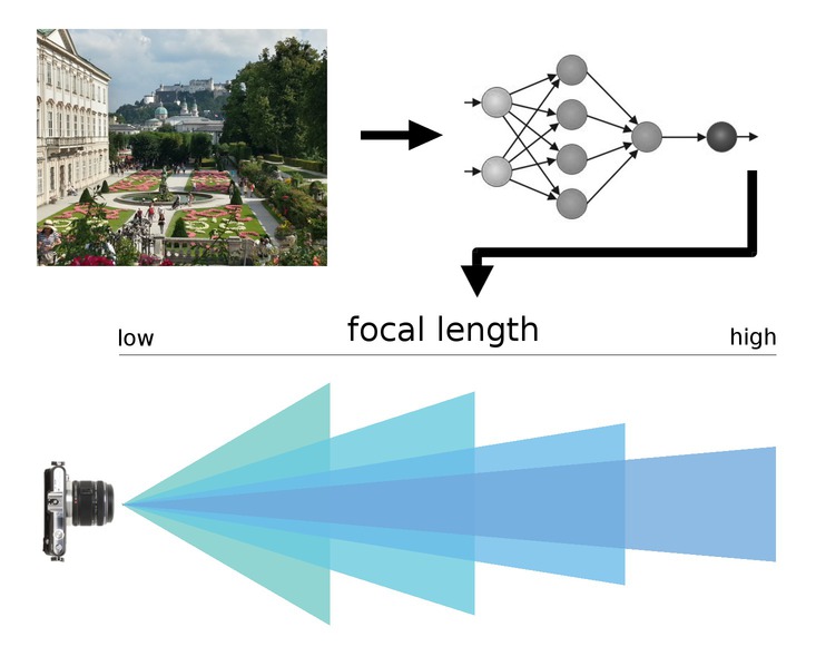
We introduce a method for directly estimating the focal length of a camera from a single image using a deep convolutional neural network.
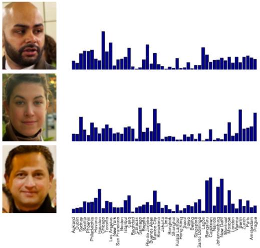
We propose a data-driven approach to solving the problem of image geo-localization using an image of a face.
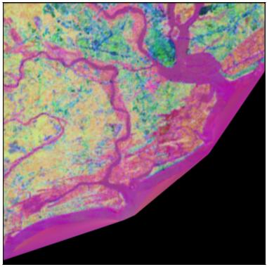
We show that features extracted from deep convolutional neural networks are useful for problems in geospatial image analysis.
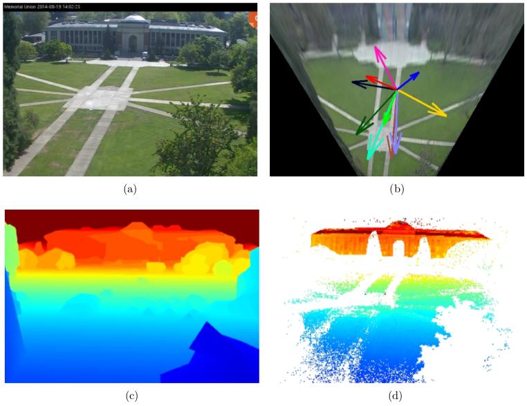
We introduce methods for estimating scene geometry in a distributed camera network using videos from partly cloudy days.
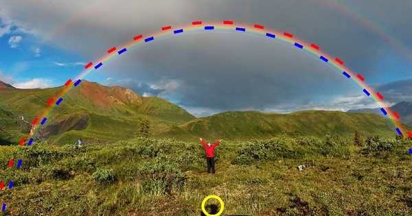
We derive constraints and demonstrate methods that allow rainbows to be used for camera geolocalization, calibration and rainbow-specific image editing.
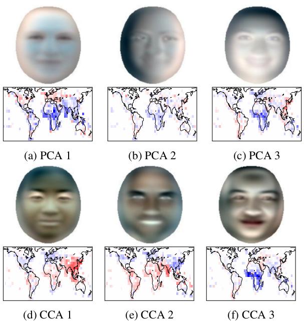
Our work explores the little-studied dependence of facial appearance on geographic location. To support this effort, we constructed GeoFaces, a large dataset of geotagged face images.
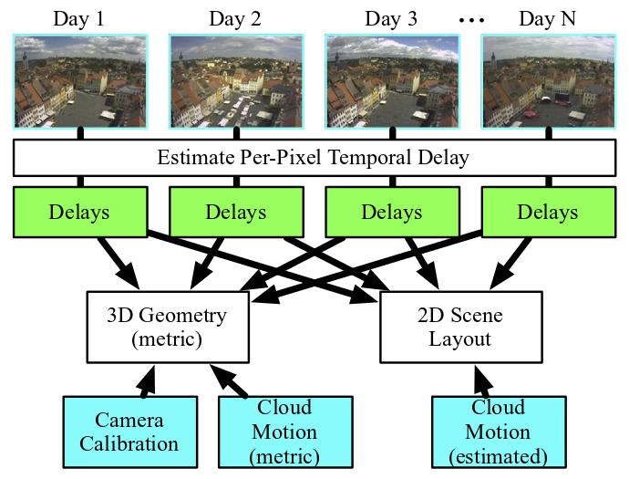
We describe new methods for estimating the geometry of an outdoor scene using video from multiple partly cloudy days.
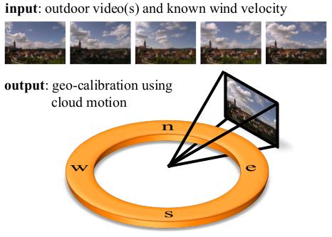
We propose cloud motion as a natural scene cue that enables geometric calibration of static outdoor cameras.