Low2High
Handling Resolution Mismatch
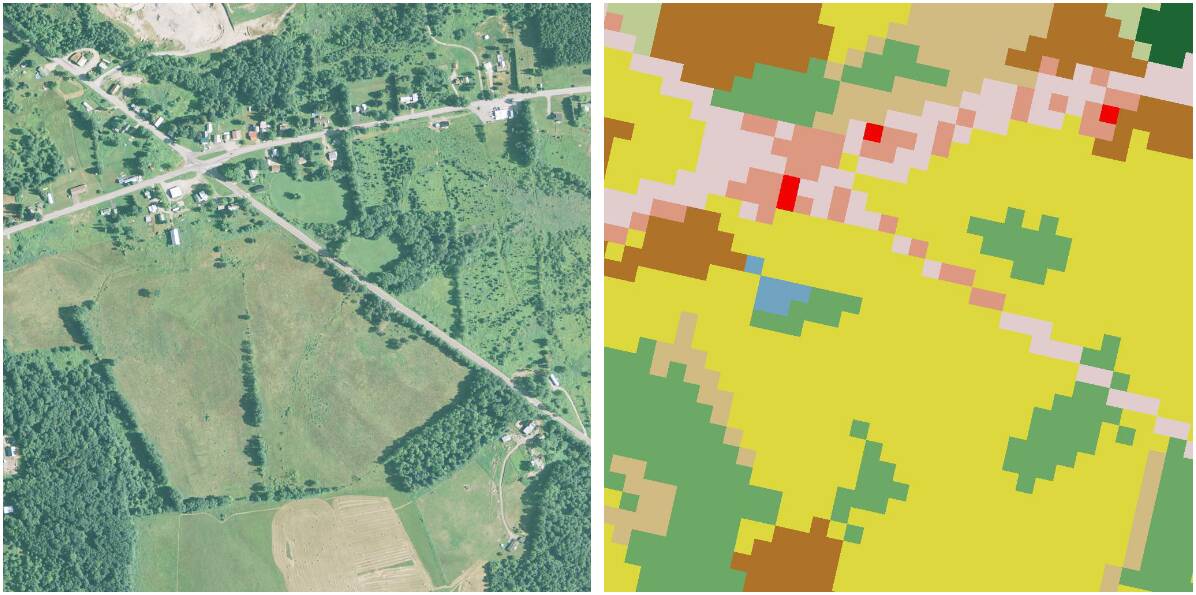
A large-scale benchmark for studying resolution mismatch, featuring 1m/pixel overhead imagery paired with coarse 30m/pixel ground-truth labels across 100,000 square miles.
Total Area
~100,000 sq. mi.
Samples
34,791 (512²)
Imagery
1m GSD (NAIP)
Mismatch
30x (1m vs 30m)
Reference Publications
Papers that introduced this dataset
Handling Image and Label Resolution Mismatch in Remote Sensing
Scott Workman, Armin Hadzic, and M. Usman Rafique
Dataset Details
Technical specifications
The Low2High dataset was introduced specifically to address the resolution mismatch problem—a pervasive challenge where high-resolution imagery is paired with coarse labels. In remote sensing, it is common to encounter significant discrepancies between imagery and ground-truth label sources, ranging from spatial misalignment due to off-nadir viewing angles to differences in temporal capture. High-resolution land-cover mapping through manual annotation is profoundly expensive (e.g., the Chesapeake watershed mapping required 10 months and $1.3M), leading most large-scale databases to provide labels at significantly lower spatial resolutions than available overhead imagery. Low2High provides a benchmark for evaluating models that can learn to predict fine-grained details from this coarse supervision, with access to additional exemplar high-resolution labels (without corresponding imagery during training).
Dataset Features
Multiscale Labels
- 30x Gap: 1m imagery paired with low-res (30m NLCD) and high-res (1m Chesapeake) labels.
- Sources: USDA NAIP aerials and unified US land cover data.
Regional Scope
- 7 States/Areas: NY, PA, MD, VA, WV, DE, and WI (Milwaukee).
- Primary Tiles: 741 large-scale tiles (yielding 34,791 processed 512² chips).
Unified Taxonomy
- Alignment: 4-class taxonomy (Water, Forest, Field, Impervious).
- Diversity: Screened for images with ≥3 unique classes.
Benchmarking
- USA* Pretraining: 12,024 auxiliary images across CONUS.
- Generalization: 3,262 held-out samples in Milwaukee, WI.